
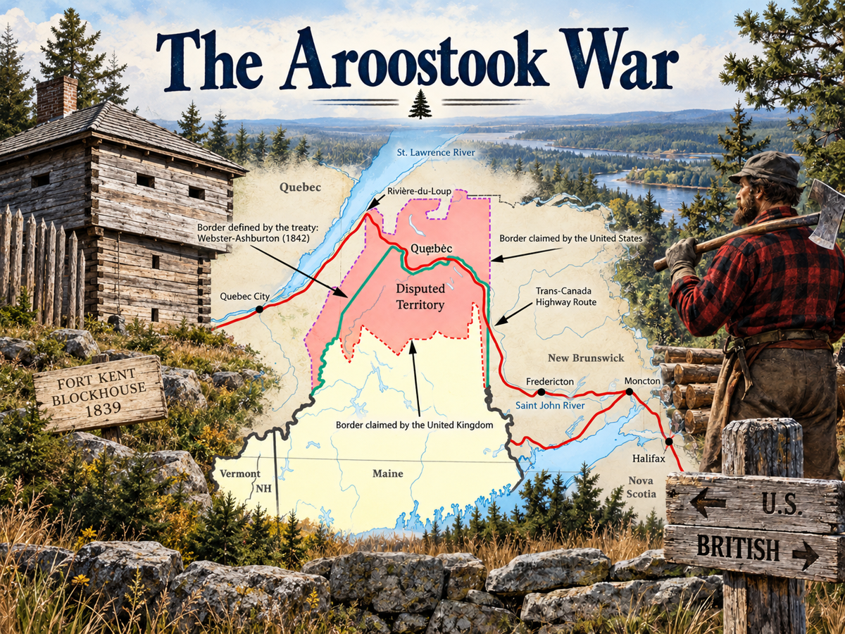
 In the far northeastern corner of the United States lies Aroostook County, Maine, the largest county east of the Mississippi River—and the setting of the Aroostook War, a remarkable border conflict that nearly brought the United States and Great Britain to blows. Covering approximately 6,826 square miles, Aroostook County is larger than Connecticut and Rhode Island combined.
The county’s enormous size—and the location of Maine’s present-day international border with Canada—result from a bitter dispute over where that border should be drawn.
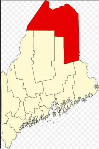
Aroostook County in red.
The story involves disputed boundaries, valuable timber, international politics and military mobilization. Although the Aroostook War never became a shooting war, thousands of troops were called up and the United States and Britain came surprisingly close to armed conflict.
The Aroostook War ultimately helped shape the roads, communities, economy and population of northern Maine. Many of the places and routes that residents use today have roots in the events surrounding this nearly forgotten confrontation between Maine and British-controlled New Brunswick.
The Maine-Canada Border Dispute
The story begins with the Treaty of Paris in 1783, which officially ended the American Revolution.
The treaty established a boundary between the United States and British North America. At the time, Maine was still part of Massachusetts. The northern boundary was intended to run considerably farther north than the border we recognize today.
But there was a problem.
Long before British control of the region, the French had developed an important transportation route connecting Halifax, Nova Scotia, and Quebec City. The route generally followed the St. John River from the Fredericton area through the Madawaska region and onward toward the St. Lawrence River and Quebec.
After the American Revolution, British authorities realized that this important communication route now passed through territory owned by the United States.
For years, the problem received relatively little attention. The disputed region was remote, difficult to reach and largely ignored by Massachusetts authorities. That changed during the War of 1812.
Britain Wanted to Protect Its Communication Route
By 1814, as negotiations to end the War of 1812 were underway, British authorities in New Brunswick recognized the strategic importance of the transportation route connecting Halifax and Quebec.
The New Brunswick Legislature acknowledged that, under the original Treaty of Paris boundary, the United States—and therefore Massachusetts—owned the territory containing the route. British authorities asked the United States to alter the boundary and give the land to Britain.
The request was refused.
The United States government argued that it did not have the authority to give away land belonging to a state.
Britain then proposed exchanging other land for the disputed territory. The United States also rejected that proposal for the same reason.
The situation remained unresolved, with British interests continuing to use the route while Massachusetts paid comparatively little attention to the remote territory.
The “Height of Land” Controversy
In 1814, New Brunswick politician Ward Chipman advanced a new argument.
Chipman claimed that the “height of land” described in the Treaty of Paris was not the location indicated by the original boundary descriptions. Instead, he argued that Mars Hill Mountain in Maine represented the intended boundary.
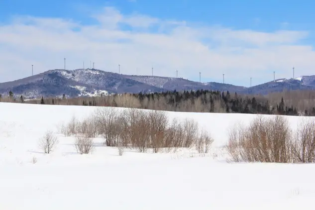
Mars Hill
According to the source material for this article, Chipman knew the claim was false but promoted it in an effort to protect Britain’s vital communication route.
The claim helped create what became known as the Disputed Territory—a vast area stretching from the northern boundary near the St. Lawrence River south toward Mars Hill and westward from there.
What began as a boundary dispute would eventually become a confrontation involving armed forces, competing land claims and the valuable timber resources of northern Maine.
Timber Turns the Boundary Dispute Into a Crisis
When Maine separated from Massachusetts and became a state in 1820, the new state government took a greater interest in the disputed northern lands.
There was good reason.
The region contained enormous stands of valuable “pumpkin” pine. Timber theft became widespread, with people—many of them British subjects—cutting trees in the disputed territory and floating the logs toward markets in New Brunswick using the Aroostook and St. John Rivers.
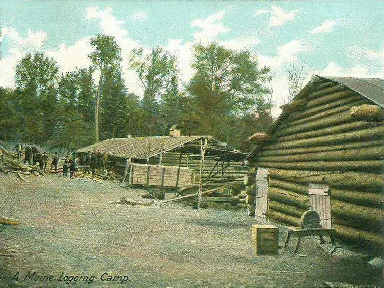
A Maine logging camp
Attempts to stop the timber theft led to increasing tensions between Maine authorities and British subjects in the region.
The remote wilderness was becoming economically valuable, and both sides had increasingly strong reasons to assert control over it.
Hancock Barracks and the Growth of Houlton
As tensions increased, the United States took steps to strengthen its presence in northern Maine.
In the summer and fall of 1828, four companies of federal troops arrived in Houlton and constructed Hancock Barracks.

Cartoon satirizing the tensions that led to the Aroostook War.
Federal troops were not permitted to participate directly in the later Aroostook War because the conflict was considered a Maine matter. But their presence had an important long-term effect.
The soldiers constructed a military road connecting Houlton and Bangor. This improved transportation between Aroostook County and southern Maine and contributed to the early growth of Houlton, which became the county’s shire town.
The military infrastructure created during this period would become an important part of Aroostook County’s later development.
The Aroostook War Begins
By 1839, the dispute had reached a critical point.
On Feb. 18, 1839, the Maine Legislature passed a resolution authorizing protection of the state’s public lands and the dispatch of militia to Aroostook County. The militia was intended to assist the land agent’s posse in stopping the continuing timber theft.
Then, on March 3, 1839, Commander Isaac Hodsdon was ordered to prepare 10,343 militia members for active service.
Ultimately, 2,904 men marched into the Aroostook territory.
The Aroostook War had begun.
Despite its name, the conflict resulted in relatively little loss of life. Nevertheless, the situation was extremely serious. An escalation could have brought the United States and Great Britain into a third major North American conflict.
Winfield Scott Helps Prevent a Larger War
In March 1839, the United States sent Winfield Scott to negotiate with Sir John Harvey, Lieutenant Governor of New Brunswick.
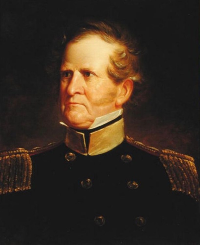
Gen. Winfield Scott
The two men had known one another from earlier military campaigns. Their negotiations produced agreements that prevented the confrontation from escalating and eventually helped bring the Aroostook War to an end.
Many of the Maine militia were discharged on March 25, 1839. Some returned home, while others remained in Aroostook or returned later to join the posse that continued protecting Maine’s public timber.
During the crisis, these men had already helped construct roads, bridges, barracks and blockhouses in preparation for possible fighting.
Some of those men eventually settled permanently in Aroostook County. Their descendants remain part of the region’s population today.
The Webster-Ashburton Treaty Settles the Border
The dispute was not formally resolved until 1842.
Lord Ashburton represented Great Britain, while Daniel Webster represented the United States. Their negotiations produced a compromise known as the Webster-Ashburton Treaty.
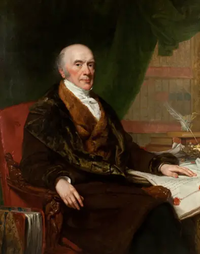
Alexander Baring, Lord Ashburton
Under the agreement, Maine lost approximately 5,500 square miles of territory, an area roughly the size of Connecticut. In return, Maine gained navigation rights on the St. John River.
The treaty was agreed to on Aug. 9, 1842, and ratified by Great Britain in 1843, bringing the hostilities to an end.

Daniel Webster in 1834
Neither side was entirely satisfied with the settlement.
Yet for residents of the disputed territory, the treaty finally established which country they belonged to. The diary of an early Oxbow, Maine, resident recorded the moment simply:
“Today we all became US citizens.”
The Aroostook War Helped Create Modern Aroostook County
The Aroostook War was far more than a brief boundary confrontation. Its effects helped shape the physical and economic development of northern Maine.
Had the original northern boundary described in the Treaty of Paris remained in place, both the geography and size of Maine would look dramatically different today.
As tensions mounted before the conflict, Maine and British authorities built transportation routes that became part of the infrastructure that connected communities across Aroostook County.
Fort Kent and Fort Fairfield
Some of the most visible reminders of the Aroostook War can still be found in Fort Kent and Fort Fairfield.
Blockhouses in both communities were built to help protect log booms on the rivers and prevent stolen timber from being floated downstream into New Brunswick.
Today, both locations preserve the memory of this period.
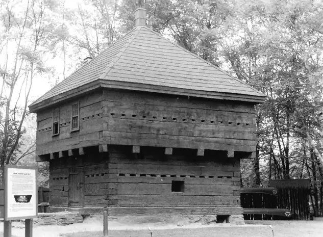
Fort Kent blockhouse before restoration
The Fort Fairfield blockhouse is a reproduction constructed from the original plans and is used as a museum. Fort Kent’s blockhouse is the original structure and has been designated a National Historic Landmark. Both have become tourist attractions and contribute to the region’s economy.
The Aroostook War’s Economic Impact
The conflict also had an unexpected economic benefit for many early settlers.
The arrival of thousands of troops created a sudden demand for food, lodging, horses, cattle, animal feed and labor. Farmers and other settlers could sell their products to the military or earn money by providing services to the troops and civil forces.
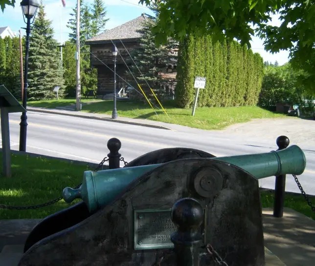
Aroostook War cannon overlooking the Fort Fairfield blockhouse
For communities that had previously struggled to make a living in the remote region, the military presence created a significant economic opportunity.
The development of roads created another lasting economic benefit.
Improved transportation connected Aroostook County more directly with southern Maine. Farmers gained better access to markets for their produce, while mail and other commerce could move through the United States instead of relying on routes through New Brunswick.
The United States’ navigation rights on the St. John River also helped create an active timber market and connected Aroostook County with shipping opportunities through New Brunswick ports.
The Border Settlement Changed Both Sides
The final settlement benefited New Brunswick in one crucial respect: Britain secured ownership of the important communication route between Halifax and Quebec, along with the surrounding territory.
That route would eventually correspond closely with the location of today’s Trans-Canada Highway.
Maine, meanwhile, retained the territory that became the Aroostook County we know today.
The war and its aftermath also encouraged further settlement.
Maine militia members were offered free land in Aroostook County for their service. Many accepted the opportunity and moved north with their families. Their arrival contributed to population growth, settlement and economic development throughout the region.
Many descendants of those early settlers still live in Aroostook County today.
The Lasting Legacy of the Aroostook War
The Aroostook War and the Maine-Canada border dispute are easy to overlook today. There were no famous major battles, and relatively few lives were lost.
But the conflict left an enduring mark on northern Maine.
It helped establish the international boundary, accelerated the construction of roads and other infrastructure and brought military investment and economic opportunities to isolated communities. It encouraged settlement and population growth. And it left behind historic sites such as the blockhouses at Fort Kent and Fort Fairfield.
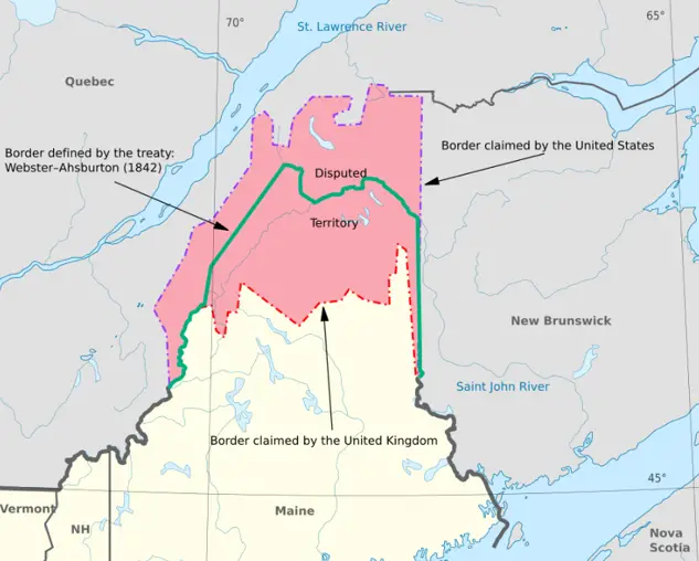
The Webster-Ashburton Treaty map
Most importantly, the events of the 1800s helped shape the Aroostook County that exists today.
The next time you travel a northern Maine road, visit one of the county’s historic forts, or cross the Maine-Canada border, you are traveling through a landscape shaped in part by a conflict that very nearly became a much larger war.
The Aroostook War may have been relatively short and bloodless, but its impact on northern Maine has lasted for generations.
Sources
- Ganong, William. A Monograph of the Evolution of the Boundaries of the Province of New Brunswick, Contributions to the History of New Brunswick, No. 5, Transactions of the Royal Society of Canada, Second Series, 1901, pp. 349–350.
- Ganong, William. A Monograph of the Evolution of the Boundaries of the Province of New Brunswick, pp. 321–322.
About the author:
Images: Mars Hill Mountain in winter: By Ricraider – Own work, CC BY-SA 3.0, https://commons.wikimedia.org/w/index.php?curid=32675406. By Webster-Ashburton treaty map-fr.svg: Dr Wilsonderivative work by Koavf – This file was derived from: Webster-Ashburton treaty map-fr.svg, CC BY-SA 4.0, https://commons.wikimedia.org/w/index.php?curid=104344936. Aroostook War cannon courtesy of the author. Featured image created by ChatGPT and Google Gemini.